Sites
Over 200 faculty, researchers and students are working at the following sites within the Saskatchewan River Basin to improve our ability to predict river flows and increase our understanding of how water quality and river basin ecosystems respond to a changing climate.
The Boreal Ecosystem Research and Monitoring Sites (BERMS) are located in the southern Boreal Plains of Saskatchewan. Originally part of the Boreal Ecosystem and Atmosphere Study, the BERMS project began in 1997 and was operated and funded by Environment and Climate Change Canada, Natural Resources Canada and Parks Canada until 2012 when the Global Institute for Water Security took over the operation and funding of select sites. The monitored area covers a number of watersheds in the southern Boreal Forest, including White Gull Creek, Torch River, Garden River and White Fox Creek. The active flux towers used to measure the energy, water and carbon balance between land and atmosphere are located within or near the gauged White Gull Creek watershed. This provides a valuable test bed for the institute to develop and evaluate coupled hydrological-ecological models.
Current scientific focus:
- Maintenance and extension of the integrated monitoring of the water, energy and carbon cycles at the BERMS sites.
- Characterization of ecosystem resilience of southern boreal forests in relation to variation in climate averages and extremes, with particular emphasis on the effects of hydrology and soil properties.
- Analysis of the climatic, hydrologic and biophysical processes that govern water, energy and carbon balances at the stand level.
- Synthesis, integration and upscaling of stand scale processes to watershed scales by developing improved hydrological models for application to the Boreal Plains ecozone and within the wider Saskatchewan River Basin model.
- Simulation of ecosystem responses of upland forest stands to environmental stressors such as climate change and air pollution using a dynamic coupled biogeochemical-vegetation model.
- Engagement of local stakeholders in the application and dissemination of research results.
Research lead: Warren Helgason
Marmot Creek Research Basin is located in the Rocky Mountain front ranges in Kananaskis Country, Alberta. The basin is a tributary to the Kananaskis and Bow Rivers and covers an area approximately 10 km2 in area, at an elevation of 1600 to 2800 m. It is instrumented with twelve permanent meteorological stations at elevations from 1450 to 2500 m, covering a variety of surface cover types and slope orientations.
Marmot Creek was used as a research basin by the Government of Canada from 1962 - 1986 to study the hydrological effects of forest management. In 2004, the U of S Centre for Hydrology, Environment Canada and the Biogeoscience Institute at the University of Calgary re-established a monitoring and research program. The Global Institute for Water Security is supporting continuation of this program and associated hydrological model development.
Current scientific focus:
- Mountain snow processes, hydrochemistry, groundwater and hydrological modelling (including climate change sensitivity analysis and hydro-climatic trends).
- Impact of forest cover change on mountain hydrology.
- Mountain hydrological model development and testing.
Research lead: John Pomeroy
A glacier mass balance program was established at Peyto by the Government of Canada in 1966 and operated by Environment Canada and now by Natural Resources Canada. The site remains a focal point for a wide range of glaciological and hydrological research and reports to the World Glacier Monitoring Program.
Current Scientific Focus
- Primarily glacier, hydrology and climate studies.
- Single meteorological station within basin adjacent to Peyto Glacier and three stations located on the glacier surface representing different elevation zones.
Research leads: John Pomeroy, Howard Wheater and Warren Helgason
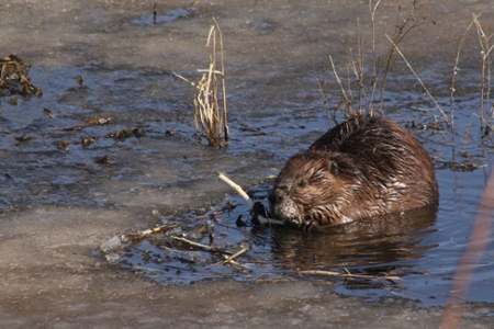
Sibbald Research Wetland is located in Kananaskis Country, Alberta in the front ranges of the Canadian Rocky Mountains, and is a 0.63 km2 valley wetland with substantial peat deposits. The peatland is drained by Bateman Creek, a tributary of Jumpingpound Creek, which flows into the Bow River. Beavers are active throughout the peatland, and a number of different sized beaver dams and ponds exist.
Beaver dams impede upstream flows and flood adjacent riparian areas. Ponds created by beaver dams function as efficient sediment traps, filling with sediment and organic materials, which can remain in the pond area even after dams are abandoned. Once abandoned, dams degrade and the water table recedes, leaving behind a “beaver meadow”, which becomes buried by more peat.
Through Global Institute for Water Security-funded research, scientists hope to determine how present and historical beaver ponds affect modern-day peat characteristics and hydrology. This will assist the institute model how different climate future will affect these important source areas for the Saskatchewan River Basin.
Current Scientific Focus
- Use of remote and ground mapping technology to quantify the spacial extent and distribution of mountain peatlands, specifically those with current or historical beaver activity.
- Beaver paleopond groundwater mapping, measurement and modelling.
- Mapping of watershed-scale soil properties.
- Measurement of the biochemical properties of peat and characterization of nutrient dynamics and organic matter quality.
- Environmental manipulation of peat cores to determine how decomposition affects nutrient dynamics, greenhouse gas emissions and carbon sequestration/release.
The current research focus of members of the Global Institute for Water Security (working jointly with Agriculture and Agri-Food Canada is to understand the fundamental drivers of threshold-like hydrological runoff responses to snowmelt and rainfall events in a semi-arid, prairie landscape. This is through analysis of high frequency, long-term data; experimental monitoring of the surface hydrology; and hydrological model building and testing.
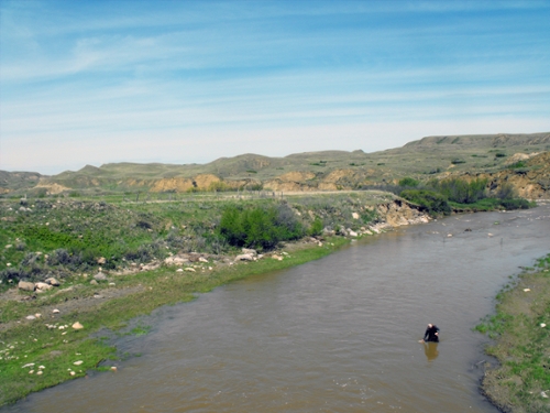
The study site consists of three adjacent, 5-hectare instrumented experimental plots in the semi-arid, agricultural region of southern Saskatchewan. The site (near Swift Current) was established by Agriculture and Agri-Food Canada’s Semi-arid Prairie Agricultural Research Centre in the late 1950s to research the effects of agricultural land management practices on runoff water quality, chemical transport and soil erodability.
The plots are instrumented with edge-of-field surface runoff monitoring. They have a long record of data collection associated with the runoff amount, water quality, land management practices, precipitation, soil characteristics and climate observations.
Research Lead: Jeffrey McDonnell
A GIWS-member research team from the U of S School of Environment and Sustainability and Toxicology Centre has received funding through the Canadian Water Network to study the effects of wastewater chemicals on aquatic environments in Saskatchewan. The research team is establishing and validating a set of techniques to characterize and assess potential effects of municipal wastewater effluent on aquatic environments. This research builds on past GIWS-funded research into the identification and assessment of chemicals of concern in the South Saskatchewan River system.
Resesarch sites and corresponding urban centres include:
- Wascana Creek, Regina
- Swift Current Creek, Swift Current
- South Saskatchewan River, Saskatoon
The research outcome is a suite of practical, effective, user-friendly and relevant tools that can be applied across Canada, and which can be easily integrated in current regulatory requirements for municipalities. To ensure these tools can meet the needs of water managers, the research team includes municipal collaborators from each of the city water treatment plants involved.
Canada has been a leader in establishing regulatory frameworks which aim to assess risks associated with endocrine-disrupting chemicals. However, no comparable attempts to harmonize testing strategies and decision-making criteria for monitoring these componds in wastewater effluent have been made. Processses which rid pharmaceuticals, personal care products, natural hormones and other contaminants from wastewater are often incomplete and inefficent. In addition, aquatic environments are at risk due to input of nutrients from agriculture sources, reduced streamflow due to extreme weather variation and increased effluent inputs from population growth and urbanization. At a time when water supply and quality may be dwindling due to climate change, such research is especially important.
Research group members: Markus Hecker (lead), Natacha Hogan, Steve Wiseman, Paul Jones, John Giesy, Howard Wheater, Chris Somers (University of Regina), Alice Hontela (University of Lethbridge), Peter Leavitt (University of Regina), Twyla Yobb (City of Saskatoon), Tim Cox (City of Swift Current), Jerry Cheshuk (City of Regina).
Lake Diefenbaker is a 200 kilometer long reservoir in Saskatchewan that provides drinking water for 25 per cent of the province's population, as well as being an important source of irrigation, hydroelectricity and recreation. However, there has been little baseline knowledge or historical data on the reservoir as a whole when it comes to ecosystem health.
GIWS established a research program at Lake Diefenbaker in 2011 to understand how the reservoir has changed since its formation and to identify stressors affecting its water quality. Working with researchers at the Universities of Regina, Waterloo, Minnesota and Oregon, and the Saskatchewan Water Security Agency, the institute released findings in the Journal of Great Lakes Research in November 2015.
Summary of 2015 Journal of Great Lakes Research Findings
The institute contributed to a special issue of the Journal of Great Lakes Research that showed what happens upstream has the most impact on the reservoir’s water quality. Of the 15 articles in the special issue, GIWS contributed 13 papers studying the physical, chemical and biological properties of Lake Diefenbaker and assessing the reservoir’s susceptibility to increasing stress.
“It appears that the flow into the reservoir has the greatest impact on water quality,” said Rebecca North, GIWS research associate and lead guest editor of the journal. “This could be a concern with increasing temperatures and lower water flows due to climate change.”
More than half of the papers in the special issue identified changes in hydrology as a principle factor affecting water quality. While there has been public concern about the potential for declining Lake Diefenbaker water quality, especially related to surface algal blooms, the researchers found little evidence that supported this perception.
“Algal blooms do occur in a portion of the reservoir—the Qu’Appelle arm—but in the rest of the lake, blooms are generally infrequent and even less frequent than other lakes with similar nutrient concentrations,” said North.
North explained that the low frequency of algal blooms may be attributed to the mixing effect of windy lake conditions and a combination of high water flows for the study period, low light penetration due to murky water and low phosphorus in the upper water column of the reservoir.
“We are predicting that the risk of algal blooms may be more prevalent during years of lower water flow, which we will continue studying in order to fully understand the factors affecting the water quality of Lake Diefenbaker.”
North added that for Lake Diefenbaker, it is the upstream activities and precipitation patterns in the Saskatchewan River basin that primarily dictate what happens to the flow levels and the potential for algal blooms.
“Based on the data we have to date, it is not the individual activities in the lake, such as the presence of the fish farming facility, the discharge of treated wastewater or cattle along the shorelines, that pose a significant risk to water quality, it’s the activities and weather patterns upstream,” said North. “Phosphorus input is of particular concern because under the right environmental conditions, fertilization due to phosphorus can create large-scale algal blooms.”
The findings suggest that land-management practices and efforts to reduce nutrient input should be focused at sites upstream to Lake Diefenbaker.
“Of all the factors influencing the lake, the water coming from the South Saskatchewan is the most important. The less nutrients in that water, the better,” said North.
This GIWS site focuses on multi-scale soil moisture sensing experiments at Brightwater Creek, located near Kenaston, Saskatchewan, in a flat and typical agricultural area. This site provides a focus for hydrological and land-surface modelling and the study of land-atmosphere feedbacks from different agricultural land use and land management practices.
Scientists have installed instrumentation to monitor spatial soil moisture, groundwater and land-atmosphere interactions at multiple scales. This research is in collaboration with Agriculture and Agri-Food Canada, Environment Canada and the University of Guelph and is a test-bed for NASA"s SMAP soil moisture remote sensing mission.
Current Scientific Focus
- Hydrological modelling and remote sensing validation.
- Flux towers for surface mass/energy balance measurements.
- Soil moisture and precipitation networks.
- Large scale soil moisture/evaporation measurements
- The site is part of the CanEx-SM10 experiment run in collaboration with NASA
Research leads: Warren Helgason and Andrew Ireson
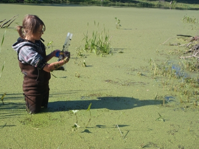
The St. Denis National Wildlife Area is a 361-hectare area that was established by Environment Canada in 1968 to monitor the effects of agricultural activities on wildlife habitat. Located about 40 km east of Saskatoon, the landscape is characterized by numerous closed-basin wetlands, known as prairie potholes, and a rich diversity of plant and animal species.
Since 1980, a number of research initiatives have been carried out, including investigations of waterfowl and habitat, hydrology and soil science. The site has a long record of data collection and scientific study and provides an excellent opportunity for integrated research on the effects of land management and climate change on the hydrology of the prairie landscape. Researchers from the Global Institute for Water Security and Environment Canada are working jointly at St. Denis.
Current scientific focus:
- Measurement of air temperature/humidity, precipitation and wind speed via two meteorological stations.
- Monitoring of tree swallow nesting activity and waterbird communities.
- Continuous monitoring of water levels in selected wetlands, to track runoff and estimate water balance.
- Monitoring and modelling of surface and subsurface hydrology and water quality response, including extreme events.
- Development of an integrated model (i.e. ecohydropedology) to improve understanding of fundamental processes.
- Testing of the model using manipulative experiments on selected watersheds.
- Linkage of the results to regional models using both local and regional transects.
Research group members: Angela Bedard-Haughn, Bob Clark, Dan Pennock, Chris Spence, Garth van der Kamp, Andew Ireson, Helen Baulch, Britt Hall, Jane Elliott, Cherie Westbrook, Christy Morrissey, Jeff McDonnell, Darcy Henderson, Heather Wilson, Dell Bayne.
Buffalo Pound Lake is a eutrophic reservoir in rural Saskatchewan which provides drinking water to residents of the cities of Regina and Moose Jaw (25% of the province's population). The lake is susceptible to algal blooms, which may increase in frequency due to high nutrient loads, and warmer weather. Water treatment processes and costs are significantly affected by lake ecology. The Buffalo Pound Water Treatment Plant relies on expensive advanced treatment processes to ensure high quality finished water, and help eliminate taste and odour caused by algal blooms.
GIWS-member researchers are developing models to provide early warning of conditions likely to lead to harmful algal blooms, or warn of major changes in lake chemistry which could affect drinking water treatment. Results will benefit the local water utility and water users, and aid in the management of other bloom-affected waters and surface water supplies. Researchers are working closely with plant managers and the Saskatchewan Water Security Agency to ensure research outcomes align with management and policy-related objectives.
- Real-time data aims to improve Moose Jaw and Regina drinking water
- Real-time data helps provide real good drinking water
Research goals:
- Using long-term data and paleolimnological techniques, investigate changes within Buffalo Pound Lake, with a focus on understanding recent changes in algal communities and odour production.
- Using a lake observatory buoy which measures physical, chemical, and biological parameters in real-time, develop monitoring tools to provide advanced warning of bloom risk. This will include the first application of a coupled hydrodynamic-ecological model to the system, informed by improved geochemical and ecological understanding of the study system.
- Characterize toxins within Buffalo Pound, with sampling informed by high frequency monitoring data.
Research group members: Helen Baulch (lead), John Giesy, Karsten Liber, Paul Jones, Lorne Doig, Karl-Erich Lindenscmidt, Peter Leavitt (University of Regina)
*Funding and logistical support for this research is provided by the Natural Sciences and Engineering Research Council of Canada (Strategic Project Grants), the Canadian Foundation for Innovation, the Buffalo Pound Water Treatment Plant, the Saskatchewan Water Security Agency, and the Global Institute for Water Security.
- Located in eastern Saskatchewan within the Aspen Parkland sub-basin of the Assiniboine River.
- Approximately 435 km2 basin characterized by prairie pothole topography, with numerous isolated wetland areas with little or no surface inflow/outflow.
- Established in 2007 by the Centre for Hydrology, U of S with funding from Agriculture and Agri-Food Canada, Prairie Habitat Joint Venture Committee, Prairie Provinces Water Board, Manitoba Water Stewardship, Saskatchewan Watershed Authority and Ducks Unlimited Canada.
- Basin has undergone rapid changes over the past 50 years, transitioning from areas of extensive woodland and wetlands to grain and oilseed cultivation.
- There has been a reduction in wetland areas from 17% to 9% during 1958 – 2001.
Current Scientific Focus - Report released June 2014: Improving and Testing the Prairie Hydrological Model at Smith Creek Research Basin. Pomery et al.
- Smith Creek is being studied to understand the effects of land use changes and drainage on eastern prairie hydrology, flooding and drought, and to develop a hydrological model for predicting these changes.
- Investigations of the role of wetlands in governing streamflow and effects of wetland drainage through modelling and experimental techniques.
- 2014 June report showed that re-establishing wetlands may decrease flood damage.
- More recent focus on water quality issues related to wetland drainage.
- Funding for various stages of the Smith Creek research basin project was provided by the Natural Sciences and Engineering Research Council, the Canada Research Chairs program, the University of Saskatchewan, Environment Canada, Agriculture and Agri-Food Canada, the Canadian Foundation for Climate and Atmospheric Sciences, Ducks Unlimited Canada, the Province of Manitoba, the Province of Saskatchewan and the Prairie Habitat Joint Venture Committee.
- Research team: John Pomeroy, Kevin Shook, X. Fang, S. Dumanski, Cherie Westbrook, T. Brown.
In December 2011, the Global Institute for Water Security secured a Canadian Water Network grant to support research to understand the effects of agricultural beneficial management practices on hydrology, water quality, and aquatic ecosystem health in the Red River Valley and Lake Winnipeg Basin. Agricultural beneficial management practices (BMPs) are used to reduce nutrient loads to sensitive aquatic ecosystems, and mitigate effects of flood and drought. Despite widespread application of these practices across North America and Europe, there remains relatively little information on their effectiveness.
Tobacco Creek is a 1,000 km2 subwatershed located in south-central Manitoba which is part of the agriculture-dominated drainage system of the Lake Winnipeg Basin. It is one of the most data-rich watersheds in Canada, where more than 20 years of research has been targeted to understanding effectiveness of several BMPs. The research has been facilitated by government scientists and university researchers from across the country in cooperation with the Tobacco Creek Model Watershed – a group of stakeholders (community members, farmers, agriculture industry, and government) and scientific researchers. The watershed is an ideal environmental laboratory for GIWS development of coupled hydrological-biogeochemical models for quantitative assessment of BMP effectiveness, and for testing agri-environmental indicators.
Read the Tobacco Creek Factsheet
Current scientific focus:
- Hydrological modelling to assess BMP effects on peak flows in cold regions
- Development of nutrient sub-models for understanding BMP effectiveness in reducing downstream nutrient export
- Testing functional indicators of nutrient status and ecological condition
- Assessing in-stream nutrient retention processes
- Design of monitoring networks capable of detecting BMP effects
- Testing high frequency sensors in challenging environments
- Contributing to long-term research legacy at Tobacco Creek, and disseminating results to local stakeholders and policy makers.
Research group leads: Helen Baulch, Howard Wheater, John Pomeroy
A team of researchers at GIWS, the School of Environment and Sustainability and the Toxicology Centre are studying the linkages between water, animals and people in the Saskatchewan River Delta to help communities plan for future scenarios and mitigate impacts to the livelihoods of residents living in the delta.
The Saskatchewan River Delta is the largest inland delta in North America and is a complex series of abandoned and active river channels, lakes and wetlands that straddle the Saskatchewan/Manitoba border. The upper delta is largely comprised of the Cumberland Marshes, and is one of the most biologically diverse habitats in Canada with an abundance of fish, waterfowl and game. Over 15,000 people live in the region - the majority in First Nations communities – and many rely on hunting, trapping and fishing for their livelihoods.
The region represents the culmination of water diverted and used in the Saskatchewan River Basin. Annual flows have decreased by around 30% since the turn of the last century, partly due to dams such as Gardiner and E.B. Campbell holding back water.
The implications of these changes in flow for the production of fish, waterfowl and mammals that depend on aquatic habitat are being addressed by an institute research team. The research helps communities in the delta understand how climate change and water resource development may affect the local habitat and plan for ways to ease the impact to their livelihoods.
Current scientific focus:
- Develop a hydrodynamic model to determine how the current and potential future flow regime of the Saskatchewan River affects the distribution of aquatic habitats in the Cumberland Marshes.
- Through stable isotope analysis, assess which of the aquatic habitats are most important in spawning/breeding and production of fish, birds and mammals.
- Using household surveys and historical resources, evaluate market and routine resource use by people in the region and assign social, cultural and economic value to this harvesting and any related conservation activities.
- Create a conceptual framework (Bayesian Belief Network) that will allow an estimation of the ecological and societal implications of future flow scenarios in the river delta.
The research expanded in 2014 with a SSHRC Partnership Development Grant to create the Delta Dialogue Network:
The Delta Dialogue Network (DDN) brings together toxicologists, social scientists, biologists and hydrologists from the U of S along with partners from the University of Manitoba, the Saskatchewan River and Delta, the Peace-Athabasca Delta in Alberta, and the Slave River Delta in the Northwest Territories. The objective is to determine which air, water and wildlife research would be most useful to help delta communities in northern Canada address the effects of climate change and regional development on downstream environments, and how best to share that information.
“Deltas are facing great challenges globally and they are the canary in our river systems,” said Toddi Steelman, executive director of the School of Environment and Sustainability and lead of the grant. “If we have a problem, the people in the deltas are the first to experience it. The Delta Dialogue Network will connect three northern delta groups and allow them to learn and share from each other in order to help sustain their distinctive northern lifestyles.”
The DDN was awarded a $199,882 Partnership Development Grant from the Social Sciences and Humanities Research Council (SSHRC) as part of a national funding announcement.